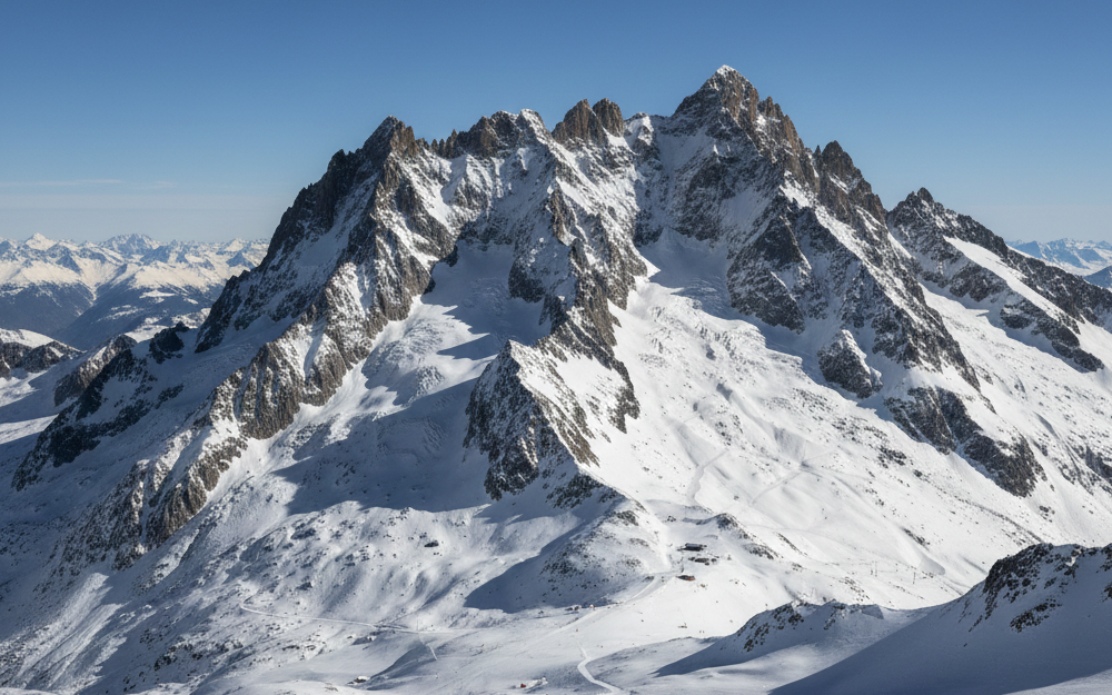
4 Vallées
Stretching across the southern wall of the Rhône Valley in the Swiss canton of Valais, the 4 Vallées is the largest wholly Swiss ski domain, uniting six resorts (Verbier, Bruson, La Tzoumaz, Nendaz, Veysonnaz and Thyon) across 410 km of piste and roughly 80 lifts. Skiing climbs from 821 m at Le Châble on the valley floor (or 1,350 m to 1,500 m in the resort villages) up to 3,330 m on the glaciated summit of Mont Fort, where a steep mogul pitch drops straight off the top cable car. Verbier is the world capital of lift-served freeriding, staging the finals of the Freeride World Tour every March on the 50-degree face of the Bec des Rosses, while Veysonnaz's Piste de l'Ours is a classic FIS World Cup downhill course.
Resort Map
Resort information
Links
Public Transport
directions_bus Public Busgondola_lift Gondolatrain Funicular
Lift Passes
There are 4 lift passes available.
Name Description Price
Verbier-Tzoumaz 6 days
6 days lift pass for Verbier-Tzoumaz
374CHF
Bruson 6 days
6 days lift pass for Bruson
290CHF
4 Vallees 1 day
1 day lift pass for 4 Vallees. (Save 10% when booked online)
94CHF
4 Vallees 6 days
6 days lift pass for 4 Vallees
409CHF
Medical Centres
Runs & Lifts
Difficulty Name Length
Alpage
1.2km
Altiport
2.4km
Attelas
2.3km
Bambino
0.5km
Bleue à Fernand
1.6km
Cabane
1.7km
Chassoure - Lacs
0.8km
Chassoure - Tortin
3.9km
Chaux R
0.9km
Chaux W
0.4km
Chemin de Moay
3.6km
Cheminée
1.1km
Cœur inférieur
1.2km
Cœur supérieur
6.0km
Col
0.6km
Col Brunet
0.6km
Col des Mines, Vallon d'Arbi/Col des Mines
1.9km
Combatseline
1.9km
Combe
1.1km
Combe du Nord
1.4km
Creblet
1.8km
Crêtes
0.4km
Croix de coeur - Planards
2.1km
Esserts-Le Rouge
0.5km
Etiértses
4.8km
FIS
3.1km
Fontaney
1.1km
Fun Slope
0.8km
Gentianes
1.6km
Gentianes - Tortin
3.1km
Grand tsai
0.7km
Grand Tsaï
0.6km
Grands Creux
0.7km
Greppon Blanc 1&2 inf.
2.0km
Greppon Blanc 1&2 sup.
2.7km
Greppon Blanc 3
0.5km
Hattey
1.7km
Jean-Pierre
2.1km
L'Eteygeon
4.2km
L'Etherolla
1.6km
La Chaux
1.2km
La Dent
0.7km
La Grande Journée (Mt-Gelé - Tortin)
2.2km
La Joc
1.2km
La Meina
0.9km
La Nationale
1.2km
La Pasay
0.7km
La Tournelle
0.9km
Lac
1.1km
Le Rouge
0.9km
Les Chottes
1.2km
Les Crêtes
0.7km
Les Drus
0.4km
Les Esserts
1.2km
Les Masses
1.6km
Les Mayens
2.5km
Les Moulins
0.3km
Matze
0.9km
Medran
0.1km
Mix
0.5km
Moay
0.5km
Mont-Fort
1.7km
Mt-Gelé - La Chaux
1.5km
Muraz
1.0km
Nendaz
1.9km
Nord
0.7km
Novelly
0.5km
Patiefray
1.8km
Petit Vallon
0.4km
Piccolo
0.3km
Pisse Vache
0.7km
Pissevache
0.8km
Pissevache 3
0.2km
Piste de l'Ours
2.2km
Piste des Profs
1.0km
Plan du Fou - Fontaines
2.0km
Plan du Fou - Siviez
2.7km
Planards
0.9km
Planards-Carrefour
0.3km
Route de Médran
1.6km
Route des Planards
1.6km
Savoleyres
1.8km
Savoleyres Nord
1.0km
Savoleyres Sud
1.1km
Savoleyres W
1.2km
Saxon
1.4km
Ski Cross
0.8km
Slow Vallon
0.1km
Snowpark
0.8km
Sur le Six
0.7km
Theytaz
0.4km
Theytaz 2
0.3km
Tortin - Siviez
2.3km
Trabanta
1.4km
Tracouet - Prarion
1.9km
Tsa
2.6km
Tsa R
1.5km
Tsa W
0.7km
Vallon d'Arbi
3.7km
Variante Pracondu
1.4km
There are 100 named pistes totaling 141km, with the longest slope being Cœur supérieur. 4 Vallées's skiable area is around 284km².
Type Name Distance
Alpage
931m
Bambino 1
138m
Bambino 2
169m
Chassoure
2117m
Chaux Express
954m
Cheminée
1072m
Combatseline
1381m
Ethérolla
1542m
Funiculaire Ecluses - Telecabine
60m
Funispace
1449m
Gentianes
409m
Greppon Blanc 1
1346m
Greppon Blanc 2
1235m
Greppon Blanc 3
636m
Inalpe
479m
Jean-Pierre
308m
Joc
1120m
Jumbo
2389m
L'Aviation
234m
La Chaux 2
1106m
La Dent
338m
La Matze
905m
La Pasay
1414m
La Tournelle
770m
Lac des Vaux 1
545m
Lac des Vaux 2
709m
Le Châble - Mayens de Bruson
2472m
Le Châble - Verbier
2198m
Le Grand - Tsai
586m
Le Rouge
742m
Les Attelas
1379m
Les Chottes
1169m
Les Drus
448m
Les Esserts
390m
Les Etablons
1344m
Les Masses
1116m
Les Moulins
313m
Mayentzet
1385m
Médran II
1513m
Médran IV
1478m
Meina
1056m
Moay
460m
Mont-Fort
1356m
Mont-Gelé
839m
Muraz
962m
Nord
1061m
Petit Vallon
315m
Piccolo
199m
Piste de l'Ours
1934m
Plan du Fou
1473m
Prarion - Tracouet
1389m
Siviez
1759m
Slow Vallon
40m
Taillay
1360m
Tapis Magique
33m
Theytaz 2
994m
TMX Savoleyres
1423m
Tortin
2160m
Tortin - Gentianes
3138m
Tournelle
172m
Trabanta
1430m
Tracouet
2099m
Tsa
539m
Tzoumaz
2666m
Verbier - Savoleyres
2115m
Veysonnaz
2450m
There are 66 lifts in 4 Vallées
Getting there
flight Plane
directions_car Car
train Train
Land At
Distance to resort
Transfer Time
Geneva International Airport
161.9km
129min
Bern Airport
162.5km
137min
Turin Airport
190.5km
182min
Annecy Meythet airport
203.0km
153min
Milan Malpensa International Airport
226.0km
219min
EuroAirport Basel–Mulhouse–Freiburg
262.5km
202min
Drive From
Distance
Travel Time
Lausanne
99.2km
95min
Bern
159.3km
128min
Geneva
166.1km
136min
Train station
Distance
Average Time
Geneva International Airport
162.1km
157min
EuroAirport Basel–Mulhouse–Freiburg
259.2km
239min
Zürich Airport
281.7km
233min