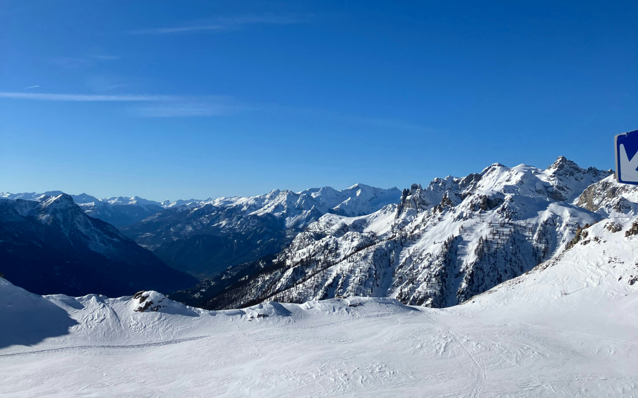
Serre Chevalier
Serre Chevalier runs for 250 km along the Guisane valley in the Hautes-Alpes, from 1,200 m at Villeneuve up to the Yret chair at 2,800 m. The valley ends at Briançon, the highest town in Europe at 1,326 m, whose Vauban fortifications are a UNESCO World Heritage site. The southern position brings more sun than the northern Alps, which is pleasant in January and a problem in a warm spring: the lower runs back to the valley road can turn to slush. The area is spread over 13 villages, so where you stay decides your day. Intermediates get long wide runs and the best of the sunshine, experts have the trees and the blacks off the Yret, and everyone gets a quieter mountain than the Tarentaise. It is good value by French standards.
Resort Map
Resort information
Links
Public Transport
Lift Passes
There are 3 lift passes available.
Name Description Price
Serre Chevalier 1 day
1 day lift pass for Serre Chevalier
68EUR
Serre Chevalier 6 days
6 days lift pass for Serre Chevalier
345EUR
Serre Chevalier 7 days
7 days lift pass for Serre Chevalier
401EUR
Medical Centres
Runs & Lifts
Difficulty Name Length
3 Croix
2.5km
Aiche
0.2km
Aiguillette
1.6km
Ailefroide
0.6km
Alpage
0.3km
Aravet
5.7km
Arthur Bauchet
0.4km
Aya
1.1km
Barres
1.4km
Bergers
1.0km
Bez
1.4km
Boardercross
0.9km
Boeuf - Clot Gaithier
0.9km
Bois
1.5km
Bois des Coqs
1.4km
Bretelle Corvaria
0.5km
Briance
5.5km
Cabane
0.4km
Casse du Boeuf
2.8km
Celvan
4.7km
Chaméant
1.1km
Chaume
1.1km
Chauvet
0.8km
Chazelay
0.3km
Chemin
4.2km
Chemin de Ronde
0.9km
Chêne
0.5km
Cibouït
1.2km
Clos Gaillard
2.7km
Clot Gauthier
1.7km
Club
0.7km
Col de l'Eychauda - Cucumelle
0.6km
Combe Râteau
0.4km
Combes
1.0km
Condamine
0.3km
Cordeliers
0.6km
Corvaria
1.9km
Couloirs
0.5km
Creux du Loup
1.3km
Crocus
0.8km
Croix Michel
0.3km
Cucumelle
2.3km
Dame des Neiges
0.7km
Draye
2.1km
Échaillon
0.9km
École Chanteloube
0.2km
École Fréjus
0.2km
Eduits
0.4km
Éduits
2.2km
Eftanis
1.5km
Escartons
0.2km
Exercice Ratier 1
0.1km
Exercice Ratier 2
0.1km
Eychauda
2.4km
Fangeas
0.7km
Forêt
0.6km
FunnyCross
0.8km
Génépi
0.5km
Goulet
3.6km
Grand Alpe
0.7km
Grand Serre
0.7km
Grande Boucle
0.2km
Grande Gargouille
2.4km
Isolée
1.6km
Jardin
0.5km
Lacets
1.0km
Lièvre Blanc
0.8km
Luc Alphand
1.9km
Marteau
4.7km
Mélèzes
0.5km
Mélèzone
1.4km
Mickey
0.3km
Moulière
0.3km
Myrtilles
1.7km
Ourson
0.1km
Pas de l'Âne
1.6km
Pelvoux
0.7km
Petit Alpe
1.5km
Pitchoune
0.6km
Prairies
0.3km
Prarian
0.6km
Pré Chabert
0.3km
Pré Jeanne
1.0km
Pylônes
1.5km
Ratier
0.1km
Remparts
1.4km
Renard
0.2km
Retour Pré Chabert
0.3km
Rochamout
3.2km
Rocher de l'Enfer
0.6km
Route des Espagnols
1.6km
Route Fréjus
5.3km
Saludes
1.6km
Sellettes
2.0km
Snow Park
0.6km
Stade
0.7km
Stade
0.3km
Stade
0.8km
Super Draye
0.7km
Tabuc
3.3km
Tétras
0.7km
Traverse
1.0km
Traversée Bayrou
0.3km
Vallons
3.6km
Vauban
1.9km
Yéti
1.0km
Yret
1.4km
There are 107 named pistes totaling 137km, with the longest slope being Aravet. Serre Chevalier's skiable area is around 108km².
Type Name Distance
Aïche
164m
Aiguillette
1411m
Alpage
516m
Aravet
1978m
Aravet 1
54m
Aravet 2
53m
Aya
1370m
Bachas
2387m
Barres
1101m
Bas
86m
Bez
171m
Blanchot
19m
Blétonet
1518m
Bois des Coqs 1
1206m
Bois des Coqs 2
1213m
Casse du Boeuf
2617m
Champcella
993m
Chanteloube 1
264m
Chanteloube 2
203m
Charmettes
76m
Chazelay
236m
Cibouït
827m
Clot
722m
Clot de l'Étoile
1109m
Clot Gauthier
1155m
Combes
1993m
Côte Chevalier
2063m
Crêtes
1157m
Croix Nore
370m
Cucumelle
322m
École de Fréjus
137m
Exercice Ratier 1
116m
Exercice Ratier 2
116m
Eychauda
1433m
Eychauda
581m
Forêt
1446m
Fréjus
2348m
Grand Alpe
437m
Grand Serre
960m
Lauzières
1223m
Méa
957m
Mickey
318m
Neiges
17m
Orée du Bois
1360m
Ourson
23m
Oursons de Pralong
29m
Patou
29m
Pitchounets
125m
Pontillas
3510m
Pralong
81m
Pré Chabert
309m
Prorel
23m
Prorel
1219m
Prorel 1
1177m
Prorel 2
2282m
Ratier
80m
Ratier
1555m
Replat
592m
Rocher Blanc
764m
Serre Chevalier
2245m
Serre Pelat
983m
Siflotte
22m
Stade
1143m
Télécorde de Fréjus
79m
Touron
141m
Vallons
2124m
Yret
1599m
There are 67 lifts in Serre Chevalier
Getting there
flight Plane
directions_car Car
train Train
Land At
Distance to resort
Transfer Time
Turin Airport
122.8km
113min
Chambéry Aix les Bains airport
168.1km
137min
Cuneo International Airport
180.0km
151min
Nice-Côte d'Azur Airport
206.2km
254min
Geneva International Airport
251.8km
193min
Lyon Saint-Exupéry Airport
255.7km
184min
Drive From
Distance
Travel Time
Turin
111.9km
114min
Grenoble
114.8km
134min
Nice
214.2km
263min
Train station
Distance
Average Time
Torino Porta Susa
117.1km
293min
Nice-Ville
209.7km
494min